Friends of South Cumberland State Parks
  • What's Happening
  • Plan Your Visit
    • Things to See and Do >
      • Park Overview
      • Park Smarts
      • Tips for New Visitors
      • Trails
      • Day Hikes
      • Overnight Hikes
      • Waterfalls >
        • Winter Waterfalls
      • Overlooks
      • Camping
      • Climbing
      • Caving
      • CCC Interpetive Area
      • Swimming
      • Paddling
    • Resources for Visitors >
      • Trailhead and Trail Info
      • Downloadable Maps
      • Information Center
      • Climbing Areas and Permits
      • Caving Areas and Permits
      • Camping Areas and Permits
      • Campground Reservations
      • Nearby Amenities
    • About the Park >
      • Park Overview
      • Park History
      • Meet the Rangers
      • Hemlock Wooly Adelgid
      • White Fringeless Orchids
      • TN State Parks Website
  • About Us
    • Our Mission
    • Our Leadership
    • Five Year Plan
    • Honorees
    • Friends MeetUp Page
    • Friends YouTube Channel
    • Friends Facebook Page
    • Friends Twitter Feed
    • Friends Instagram Feed
    • Friends Snapchat Feed
  • What We Do
    • Conservation and Protection
    • Trails Team
    • Trail Friends
    • ParkSmarts
    • Back the Rangers Program >
      • Storm Damage Clean Up
    • TN Naturalist Program
    • Fiery Gizzard Trail Reroute
    • CCC Camp Restoration
    • Mack Prichard Legacy Project
    • Trails and Trilliums Festival
    • Goldenrod Gala
    • Picture the Park Photo Contest
    • Every Child in the Park >
      • Healthy Horizons
      • Discover Together
    • Wildlife Programs
    • Hike Challenges
    • Pioneers of the Park
    • Telling the Park Story >
      • Orientation Videos >
        • Park Basics Video
        • Trailheads Video
        • Waterfalls Video
        • Historic Video
        • Camping Video
        • Topography Video
    • Trail Counter Program
  • You Can Help
    • Join the Friends
    • Renew Your Membership
    • Make a Gift
    • Volunteer Opportunities
    • Donate Your Park Photos
  • Member Services
  • Our Partners
  • Contacts

Hike Into History | “Natural History of the South Cumberlands”

Highlights for a self-guided hike

Trailhead:  Collins West (off 51st Avenue) Gruetli-Laager, TN  [map]

"Natural History of the South Cumberlands" takes you to some of the most spectacular places in South Cumberland and Savage Gulf State Parks. You'll traverse the breathtaking rock amphitheater at Suter Falls; cross Fall Creek and make your way down, out of the sandstone "cap" that protects the Cumberland Plateau, through the shale layer and finally into the limestone layers below.  There, you'll come to Horsepond Falls and can see one of the many caves the water has carved out of the softer limestone.

Leaving the Savage Gulf South trailhead, here are some of the trail highlights:

» 0.3 miles | Short side trail to spectacular overlook of Collins Gulf
» 0.5 miles | Bear left onto trail down to Suter Falls
» 0.6 miles | Impressive rock amphitheater at Suter Falls
» 1.0 miles | Begin descent from sandstone thru shale into limestone
» 1.8 miles | Short side-trail to Horsepound Falls
» 2.2 miles | Fall Creek disappears into a cave in the limestone formation (please do not enter the cave - not safe!)

At this point you can turn around and retrace your steps to the trailhead, or continue to explore further down the Collins Gulf

Total trail distance:  about 4.4 miles  | moderately to very strenuous
Picture
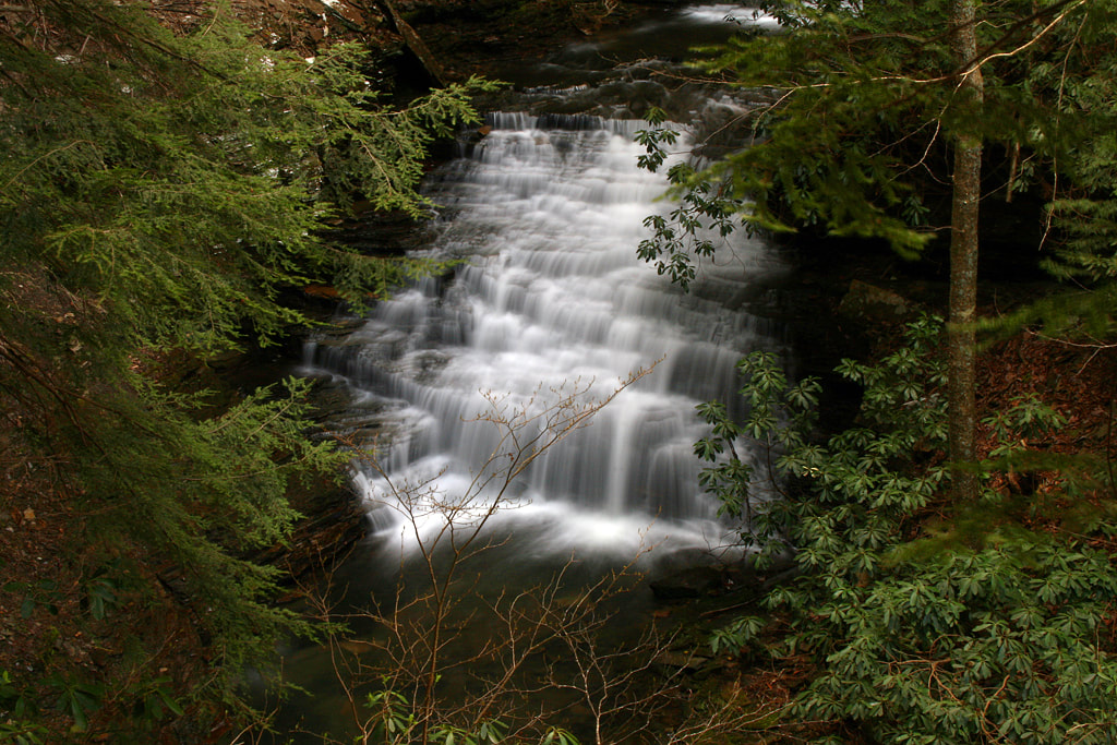
The cascade of Fall Creek, just below Suter Falls, visible as you traverse the enormous rock amphitheater that embraces both the falls and cascade below.
Back to "Hike Into History"
©2022 Friends of South Cumberland State Parks, Inc.
Post Office Box 816 | Sewanee, TN 37375

Picture
Picture
Picture